Table of Contents
Cheylesmore info
Map
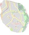
 Showing the district of Cheylesmore which is located on the south side of the City Centre of Coventry, UK. It bounds Whitley, Styvechale, Earlsdon and Coventry city centre.
http://www.openstreetmap.org/?lat=52.3883&lon=-1.5063&zoom=14&layers=M.
If you have any further information, please email me on cheylesmore atsymbol rainsbrook dot co dot uk.
Pictures
Road Names
Daily Telegraph, 1935 - How the streets in Cheylesmore were named
| Place Name | Information |
|---|---|
| Mile Lane | |
| The Martyrs' Close | 12 Protestant martyrs who were burned to death at the stake under Henry VIII between 1510 and 1555 In “Little Park” (Little Park Street) (http://www.bbc.co.uk/dna/h2g2/A30652616) (See also Laurence Saunders Road in Radford) |
| Thomas Landsdale Street | One of the 12 Protestant martyrs |
| Wrigsham Street | Master Wrigsham, one of the 12 Protestant martyrs |
| Hockett Street | Robert Hockett, one of the 12 Protestant martyrs |
| Joan Ward Street | one of the 12 Protestant martyrs |
| Glover Street | Robert Glover, one of the 12 Protestant martyrs |
| Silksby Street | Robert Selkeb or Silksby, one of the 12 Protestant martyrs |
| Cornelius Street | Cornelius Bongey, one of the 12 Protestant martyrs |
| Litchfield Road | One of the locations of John Grace's sermons |
| Queen Isabel's Avenue | Named after Queen Isabel, a royal owner of Cheylesmore Manor. |
| Hermit's Croft | |
| John Grace Street | A Dominican monk associated with the Lollard Movement |
| St Christian's Close | |
| St Christian's Road | |
| Lollard Croft | see Lollard Movement above. |
| The Mount | |
| Purefoy Road | William Purefoy, http://www.british-civil-wars.co.uk/biog/purefoy.htm |
| Galeys Road | |
| Baron's Field Road | |
| Courtleet Road | Court Leet - an ancient body made up of the High Bailiff, the Low Bailiff and the Court Leet Jury, http://www.west-midlands.police.uk/about-us/history.asp |
| Frankpledge Road | frankpledge was a form of collective responsibility for good conduct, (The Oxford Companion to British History), system by which each member of a tithing was responsible for every other. (The Concise Oxford Dictionary of English Etymology) |
| Calder Close | |
| Daventry Road | The road leading to Daventry |
| Quinton Road | |
| Franciscan Road | Monastical Order |
| Benedictine Road | Monastical Order |
| Carthusian Road | Monastical Order |
| The Hiron | |
| Stoney Road | |
| Humphrey Burton's Road | Landowner, 1647, http://www.british-history.ac.uk/report.aspx?compid=16011 |
| Townends Road | |
| Orchard Crescent | |
| Asthill Grove | |
| Asthill Croft | |
| Adare Drive | |
| Cecily Road | Possibly http://en.wikipedia.org/wiki/Cecily_Neville,_Duchess_of_York |
| Montalt Road | |
| Crecy Road | Battle in the Hundred Years War (http://en.wikipedia.org/wiki/Battle_of_Crecy) |
| Agincourt Road | Battle in the Hundres Years War (http://en.wikipedia.org/wiki/Battle_of_Agincourt) |
| Black Prince Avenue | Edward of Woodstock, Prince of Wales, Duke of Cornwall, Prince of Aquitaine (http://en.wikipedia.org/wiki/Edward,_the_Black_Prince) |
| Troyes Close | |
| Kent Close | |
| Eltham Road | |
| William Bristow Road | Henry William Bristow (http://en.wikipedia.org/wiki/Henry_William_Bristow) |
| Seneschal Road | |
| The Park Paling | Named after the original medieval paling fence surrounding the Cheylesmore Estate. |
| Esher Drive | |
| Rosegreen Close | |
| Woodstock Road | Possibly Edward of Woodstock, the Black Prince. |
| Ebbw Vale Terrace | |
| Poiters Road | Battle of Poitiers, http://en.wikipedia.org/wiki/Battle_of_Poitiers |
| Arundel Road |
This page has been accessed for:-
Today: 1
Yesterday: 0
Until now: 819
